


Bangladesh Navy Hosts Two-Day 15th National Hydrographic Committee Meeting in Chattogram
The Bangladesh Navy successfully convened the 15th meeting of the National Hydrographic Committee (NHC) at BNS Isa Khan, highlighting the country’s sustained commitment to maritime safety, sustainable use of coastal resources, and coordinated hydrographic development. The two-day forum, which concluded under the chairmanship of Assistant Chief of Naval Staff (Operations) Rear Admiral Mohammad Musa, brought together representatives from around 25 maritime and allied organisations to exchange perspectives, enhance multi-agency collaboration, and support Bangladesh’s maritime strategic objectives.
The meeting’s agenda encompassed deep discussions on key issues that affect national maritime operations from hydrographic surveying and nautical charting to climate risk management, pollution control, fisheries oversight, and development planning reaffirming hydrography’s central role in national safety and economic growth.
Strengthening Maritime Coordination and Safety
Hydrographic surveying systematic mapping of coastal waters, seabeds, and navigational routes is a critical prerequisite for safe navigation of seagoing vessels and the growth of the blue economy. The National Hydrographic Committee’s 15th meeting reaffirmed that hydrographic data and nautical charts are indispensable tools for government bodies, port authorities, offshore stakeholders, fishing communities, and commercial shipping actors.
Rear Admiral Mohammad Musa emphasised that enhanced cooperation among maritime organisations will streamline data sharing, training, and operational synergies, ultimately enabling safer, more efficient maritime activity across Bangladesh’s coastlines and economic zones.
Historical Context: Bangladesh’s Hydrographic Journey
Bangladesh’s commitment to hydrographic services dates back to 1983, when the Bangladesh Navy launched its Hydrographic Service in alignment with the International Maritime Organization’s (IMO) Safety of Life at Sea (SOLAS) Convention. Under SOLAS, coastal states are responsible for providing accurate hydrographic services and nautical charts to facilitate safe navigation in their waters.
In 2001, Bangladesh joined the International Hydrographic Organization (IHO), a global body dedicated to setting international standards in hydrography. That same year, the National Hydrographic Committee was established through a notification from the Ministry of Defence, formalising multi-institutional coordination on hydrographic matters.
Today, nearly two decades after its inception, the committee unites nearly 25 maritime and allied institutions, including various government ministries, autonomous agencies, and technical departments involved in offshore, environmental, and navigational operations.
Key Focus Areas of the 15th NHC Meeting
The 15th meeting covered a broad spectrum of topics that reflect Bangladesh’s evolving maritime priorities. Sessions focused on:
1. Ocean Surveys and Seafloor Mapping
Participants discussed advanced approaches to hydrographic and oceanographic surveying, including technologies for updated nautical charts, bathymetric data gathering, and the integration of marine spatial data in national planning.
Hydrographic surveys capture essential details about seabed topography, water depth, and navigational hazards, forming the backbone of safe coastal travel and supporting emergency response initiatives.
2. Offshore Installations and Resource Management
With offshore economic zones gaining prominence, the meeting addressed offshore installations, including oil and gas platforms, wind farms, and marine infrastructure. Ensuring safety, environmental protection, and coordination among agencies is essential as Bangladesh explores its blue economy potential.
3. Pollution Control and Environmental Sustainability
In light of rising environmental pressures, discussions touched upon strategies to monitor and mitigate marine pollution, a priority for ecosystem conservation, safe fisheries practices, and tourism development.
4. Fisheries and Port Development
Fishing remains a major livelihood driver in coastal regions, and port operations are central to trade and logistics. Harmonising hydrographic data with fisheries management and port planning enhances productivity while reducing risk.
5. Climate-Related Risk Management
With coastal regions vulnerable to cyclones, sea-level rise, and extreme weather, the committee explored ways to link hydrographic information with climate risk assessments. Data driven by hydrographic surveys can be pivotal in adaptive planning and disaster response frameworks.
6. Information Exchange and Training
Committee members reaffirmed the need for strengthened information sharing protocols and hydrographic training, including joint exercises, data platforms, and capacity building to ensure interoperability and shared knowledge across agencies.
7. MSDI and MSP Frameworks
Discussions also included Marine Spatial Data Infrastructure (MSDI) and Marine Spatial Planning (MSP) frameworks, which are integral to organizing coastal data, supporting policy decisions, and balancing economic use with environmental stewardship.
Field Visits and Practical Engagement
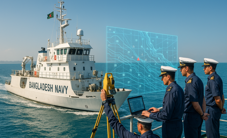
Beyond the meeting room, participants also had the opportunity to observe real-time hydrographic operations. The event included visits to the Hydrographic and Oceanographic Center of the Bangladesh Navy, where officers demonstrated specialised practices, tools, and technologies used in marine surveying.
In addition, delegates witnessed at-sea hydrographic activities aboard a Bangladesh Navy survey ship, offering firsthand insight into how data is collected, processed, and applied. This practical component underscores the committee’s emphasis on applied learning and operational transparency.
Bangladesh’s Growing Regional Role in Hydrography
Bangladesh’s contributions to regional and international hydrographic initiatives have not gone unnoticed. In recognition of its expanding role and adherence to international standards, the Bangladesh Navy currently holds the Chairmanship of the North Indian Ocean Hydrographic Commission (NIOHC) for the 2025–2027 term, a significant achievement on the global maritime stage.
The NIOHC brings together nations adjacent to the northern Indian Ocean to coordinate hydrographic activities, share best practices, and promote capacity building. Bangladesh’s leadership role reflects the nation’s growing expertise, technical investments, and strategic engagement in international maritime safety protocols.
Implications for National Development and the Blue Economy
Hydrographic data and capabilities have direct implications for multiple sectors of national development:
Safe Navigation: Updated charts reduce shipping risks and improve trade flow efficiency.
Maritime Security: Detailed seabed mapping enhances naval and coastguard operations.
Infrastructure Planning: Hydrographic insights aid port expansion and offshore installations.
Disaster Preparedness: Survey data supports coastal hazard modeling and response planning.
Environmental Monitoring: Tracking seabed and water changes informs pollution control and ecosystem protection.
As Bangladesh invests in port modernization, offshore renewable energy, and coastal tourism, the foundational role of hydrography becomes ever more crucial.
Innovation, Integration, and Collaboration
The 15th National Hydrographic Committee meeting reaffirmed a shared commitment to expanding Bangladesh’s hydrographic capabilities. Participants expressed optimism that enhanced cooperation, knowledge exchange, and technological integration will elevate the country’s role in regional maritime sciences.
Chair Rear Admiral Mohammad Musa emphasised that sustained coordination among government agencies, technical institutions, and international partners will further strengthen Bangladesh’s maritime economy and safety architecture.